https://www.axera.co.jp/edo100views/index.html
Ukiyo-e series drawn by Hiroshige Ando in the Edo period,
100 Famous Views of Edo, the place where it was set
I asked him what was actually happening now.
Click here for Japanese version.
https://www.axera.co.jp/edo100/index.html
Please see the homepage for all the explanations.
I visited the actual location of my favorite 100 Famous Views of Edo, painted by Hiroshige Ando, to see what the scene looks like today.
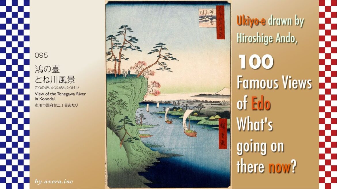
The “View of the Tonegawa River in Konodai” in #095 is a view of the Edo River and beyond from the side of Satomi Park in Konodai. It seems that the character “ko” in Konodai was applied to this character because many storks (ko-no-tori) had been living in this area since ancient times. The bird is now listed as an endangered species, but it was so common in this area for a long time.
The village on the right is the current village around Koiwa. Today, Keisei’s Edogawa Station has been built here.
Fuji is depicted in the middle right. However, as seen on the map, Mt. Fuji is not visible in this direction. It is thought that Hiroshige included Mt. Fuji in the painting as a story based on an anecdote from this neighborhood.
Please see the map showing the elevation differences in this neighborhood. Since ancient times, this Konodai area has been surrounded by the sea and rivers to the west and east, and many ancient burial mounds have been confirmed, indicating that human life has been conducted here since ancient times.
Here is a quick look at the history of the Konodai area.
It is also believed that there was a township of a great clan ruled by Kuninomiyatsuko (a bureaucrat) before the establishment of the Ritsuryo (law) system. The previous Tekona-den theory refers to this period. In any case, Konodai seems to have been a strategic point in the Kanto area.
After the Taika-no-Kaishin Reforms that began in 645, the Shimousa Provincial Government was established here, and at the same time, Kokubunji and other temples were built, creating a grid-like city similar to Kyoto.
In 939, Taira no Masakado, who had no choice but to seek to establish an independent state in the Kanto region after falling for the Yamato court’s trickery, attacked Konodai, and the power of the provincial governments in the three provinces of Boso (Kazusa, Shimosa, and Awa) rapidly declined.
In 1180, Minamoto no Yoritomo, who had fled to Nanso after his first defeat, entered Shimousa Province, where he gathered some 30,000 soldiers and marched them to Kamakura, laying the foundation for the establishment of the samurai government that followed.
In 1479, Ota Dokan built a fort in Konodai to defeat the Chiba clan, which later became “Konodai Castle.
From 1538, the Odawara Hojo clan attacked the Boso Satomi clan, which had taken up camp at Konodai Castle twice, and Konodai Castle came under the jurisdiction of the Hojo clan.
In 1590, when Toyotomi Hideyoshi destroyed the Odawara Hojo clan, Konodai Castle came under the jurisdiction of the Tokugawa clan.
However, Tokugawa Ieyasu abandoned the castle on the grounds that a fortress overlooking Edo was dangerous.
To see the location of the area in relation to Edo, I put Hiroshige’s viewpoint in white gradient on a map that shows a little wider area and height differences.
In the current map, the Arakawa River has been rehabilitated and flows through the area due to river improvement, but at that time, the Tone, Arakawa, Watarase, and Iruma Rivers flowed into Edo Bay in an irrigation system, and the blue and greenish areas on this map were almost always flood-prone areas.
Goods brought by ship from the Kanto region and northward were generally transported from Choshi around the Boso Peninsula and into Edo Bay.This was also an unstable course, dependent on the weather at sea.
In order to rectify this situation, the shogunate initiated the “Tosen Project. In an era when there were no construction machines, it was a grandiose plan to change the flow of several rivers.
Now, I have actually been here.
It is not a cliff, but a large cover of trees. The upper left is Konodai, which has been developed as Satomi Park, and you can go up from behind this. The small railway bridge in the distance is the Keisei Line crossing the Edogawa River.
The current view is framed in Hiroshige’s painting.
Among the 100 Famous Views of Edo, this painting is pregnant with various histories. People have lived in this Konodai since ancient times, and as time went by, various people passed by, leaving behind various stories. In Edogawa as well, various people and things passed through every day. Standing in Satomi Park, one can feel these things passing by in the breeze.
Finally, we included storks in the landscape, which are said to bring happiness to the places where they live.

