
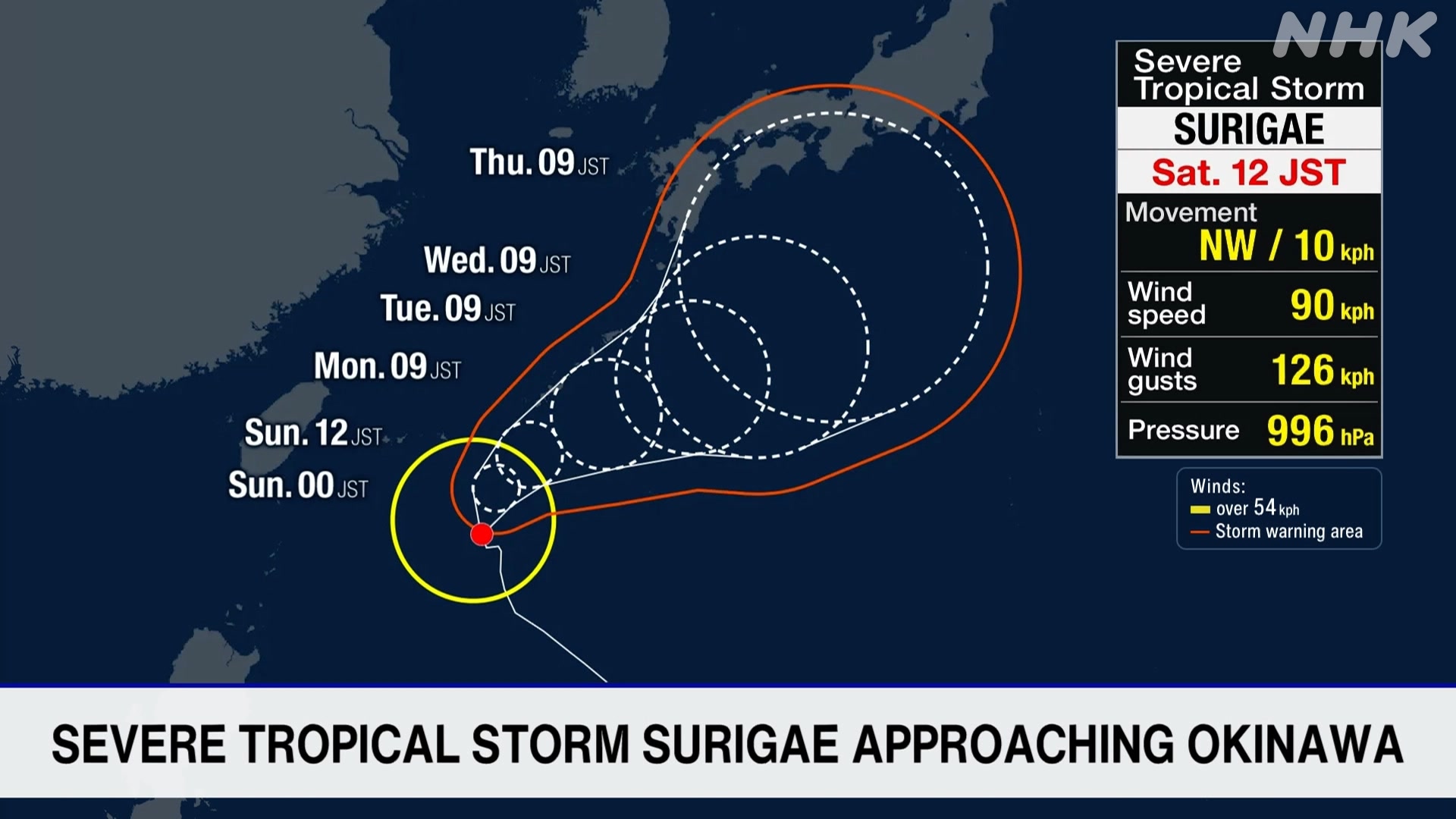
Japanese weather officials say Severe Tropical Storm Surigae will likely approach Okinawa, bringing very strong winds and rough seas to the southwestern Japanese prefecture from Sunday onward.
The Japan Meteorological Agency says that as of 9 a.m. Saturday, Surigae was moving northwest over waters south of Okinawa at a speed of 10 kilometers per hour.
The storm has a central atmospheric pressure of 996 hectopascals. It is packing sustained winds of up to 90 kilometers per hour near its center, with gusts peaking at 126 kilometers per hour.
The agency says Surigae is expected to continue moving northward and come close to Okinawa as it develops.
A maximum sustained wind speed of about 83 kilometers per hour is expected on Sunday in the Okinawa main island region while the Miyakojima Island region can expect winds around 65 kilometers per hour.
Peak gust speeds will likely reach 126 kilometers per hour in the Okinawa main island region and 108 kilometers per hour in the Miyakojima Island region.
Meanwhile, a seasonal front is bringing rainfall to wide areas from eastern to western Japan. Torrential rain with thunder could hit the Kanto, Tokai and northern Kyushu regions on the latter half of Saturday.
In some areas of the Kanto region, the ground is already saturated by recent heavy rain and some levees have been damaged.
The Meteorological Agency is urging people to stay on high alert for landslides, swollen rivers and flooding in low-lying areas.
AloJapan.com