
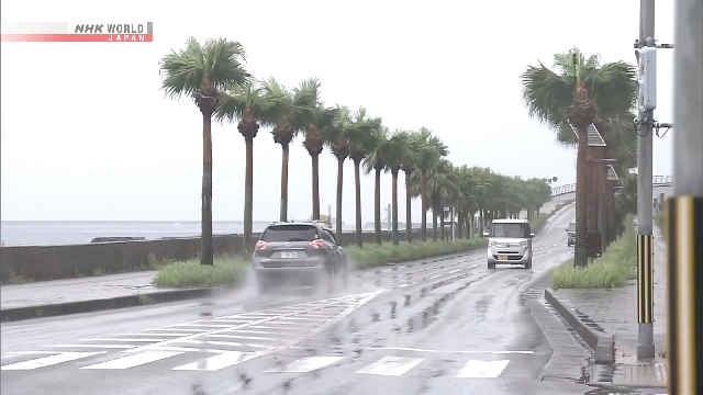
Typhoon Saudel is moving away from Japan’s southwestern regions of Amami and Okinawa. But the typhoon’s impact is expected to linger.
People are advised to take extra precautions against landslides, flooding, and swollen rivers in low-lying areas caused by heavy rain, as well as high waves and strong winds.
The Amami and Okinawa regions seem to be already out of the storm zone, but rainclouds are still hanging over the regions.
For the 24-hour period through Thursday noon, rainfall of up to 120 millimeters is forecast in Okinawa Prefecture and 100 millimeters in the Amami region of Kagoshima Prefecture.
Strong winds are also forecast to continue. Maximum wind speeds of 83 kilometers per hour and gusts of up to 126 kilometers per hour are expected in the Amami and Okinawa regions.
Waves of up to 7 meters are expected in Okinawa Prefecture and up to 6 meters in the Amami region.
From Tuesday through Wednesday, extremely strong winds blew in the Amami region and Okinawa’s main island.
A maximum wind speed of 196 kilometers per hour was recorded in Amagi Town, Kagoshima Prefecture, shortly after 7 p.m. on Tuesday.
During the three-hour period through 11 a.m. on Wednesday, maximum wind speeds of 108 kilometers per hour were observed in Uruma City, and 90 kilometers per hour in Naha City, both in Okinawa Prefecture.
Extremely heavy rain fell in the Amami region. Rainfall of 101 millimeters was recorded in Tokunoshima Town, Kagoshima Prefecture, during the one-hour period through 11 p.m. on Tuesday. The weather agency issued an emergency warning, confirming that bands of heavy rain clouds had developed.
In Amagi Town, Kagoshima Prefecture, the total rainfall during the 24-hour period through 11 a.m. on Wednesday reached 237 millimeters, exceeding the town’s average rainfall for the entire month of August.
Emergency warnings for landslides were in effect in some areas of the Amami region as of 11:45 a.m. on Wednesday.
AloJapan.com