

Typhoon Dolphin, the equivalent of a Category 1 hurricane, is bearing down on mainland China and is expected to make landfall Sunday. FOX Weather Meteorologist Jane Minar analyzes the storm threatening parts of Asia and takes a look at what’s brewing on the other side of the Pacific.
Typhoon Dolphin is entering its final stage as it tracks across the Western Pacific, as it’s expect to make landfall in mainland China on Sunday after barreling past Japan’s Ryukyu islands.
Dolphin is currently equivalent to a Category 1 hurricane, but is not forecast to again reach super typhoon status. A typhoon is the term used for a hurricane in the Western Pacific.
EL NIÑO COULD MEAN MORE TROPICAL ACTIVITY FOR THE WESTERN PACIFIC
Winds from Typhoon Dolphin howl through Amami, Japan, on August 6, 2026.
Dolphin reached super typhoon status last Friday, with winds over 165 mph — the equivalent of a Category 5 hurricane.
Social media video from Amami, Japan, showed howling winds as the storm blew past the Ryuku Islands Thursday.
MAJOR ATLANTIC HURRICANE LANDFALL ODDS ‘WELL BELOW-AVERAGE’ THIS SEASON DUE TO IMPENDING SUPER EL NIÑO
U.S. military bases in Okinawa, Japan, ordered all personnel to stay indoors after officials raised a Tropical Cyclone Condition of Readiness Emergency on Thursday morning local time.
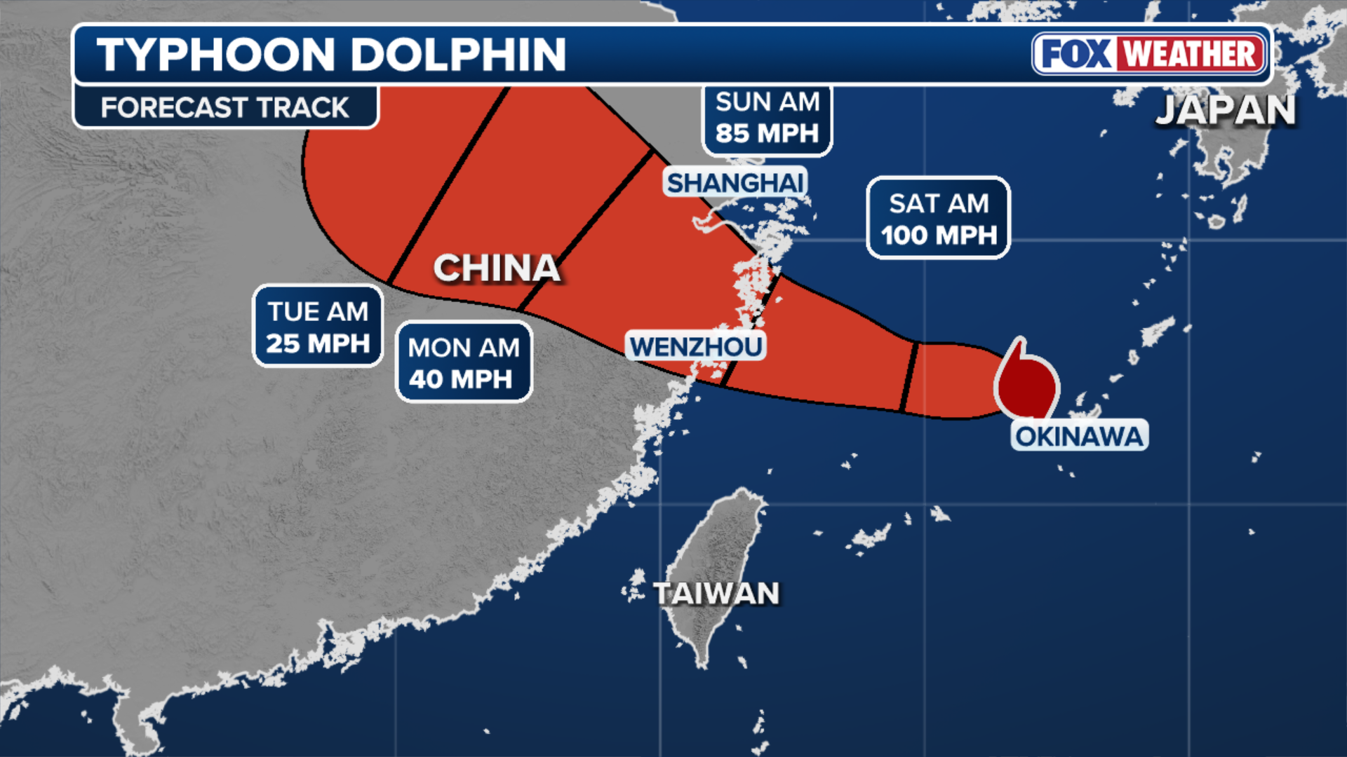 This graphic shows the forecast track of Typhoon Dolphin.
(FOX Weather)
The storm is expected to slow and weaken before making landfall in Zhejiang Province, China, by early Sunday.
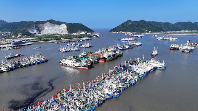
Images from along the coast there showed boats lashed together in harbors in preparation for the typhoon.
Shanghai is expected to see impacts from the storm, including tropical storm-force winds, storm surge and local flash flooding.
next
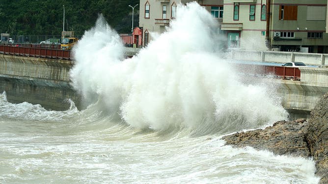
WENLING, CHINA – AUGUST 05: High waves pound the coast on August 5, 2026 in Wenling, Zhejiang Province of China.
((Photo by VCG/VCG via Getty Images))

prevnext
TOPSHOT – People (R) react as large waves break along a seawall ahead of the expected landfall of Super Typhoon Man-yi, in Legaspi City, Albay province on November 16, 2024.
(CHARISM SAYAT/AFP )
prevnext
TAIZHOU, CHINA – AUGUST 06: Fishing boats dock at a harbor as Typhoon Dolphin approaches on August 6, 2026 in Taizhou, Zhejiang Province of China. As Typhoon Dolphin, the 13th typhoon of 2026, is approaching the East China Sea, Zhejiang.
((Photo by Jiang Youqing/VCG via Getty Images))

prevnext
WENLING, CHINA – AUGUST 05: Fishing boats are docked at Ruoshan Fishing Port as Typhoon Dolphin, the 13th typhoon of the year, approaches on August 5, 2026 in Wenling, Zhejiang Province of China.
((Photo by Zhou Xuejun/VCG via Getty Images))

prev
People struggle with their umbrellas in high winds brought by Super Typhoon Saola next to Victoria harbour in Hong Kong on September 1, 2023.
(ISAAC LAWRENCE/AFP)
There has been a lot of activity in the Western Pacific this year, with the basin already producing 165.6 Accumulated Cyclone Energy (ACE), more than double its season-to-date average.
ACE is a wind energy index developed by Colorado State University that measures the intensity and duration of tropical cyclones throughout a given season.
THUNDERSTORMS, HUMIDITY TO GRIP OHIO VALLEY, EAST COAST AS MULTIDAY STORMS PLACE MILLIONS UNDER FLOOD THREAT
“Typically, an extremely active season is classified by an ACE value above 159.6,” the FOX Forecast Center said.
“An above-normal season ranges from 126.1 to 159.6, while a below-normal season has an ACE value below 73.”
 This graphic shows the path of Typhoon Dolphin.
(FOX Weather)
The FOX Forecast Center noted Typhoon Dolphin’s impressive strength over its lifespan. Dolphin alone has an ACE value surpassing 43, contributing significantly to the Western Pacific’s active 2026.
AloJapan.com