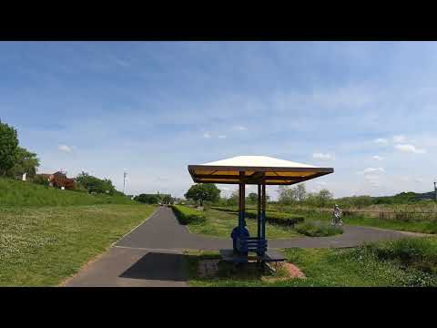
Date recorded: Around 13:20 in May 2021
Temperature: 24 °C / 75 °F
On Japan’s golden week holiday of 2021, I walked about 68 km (about 18 hours) along the Tama River from Ome station to Haneda Airport.
In this episode #3, I continued walking from Nagata Bridge to Haijima Natural Park 永田橋 → 拝島自然公園. Let’s walk and enjoy the natural sceneries along this river to the sea together.
The Tama River (多摩川, Tama Gawa) is a major river in Yamanashi, Kanagawa and Tokyo Prefectures on Honshu, Japan. It is officially classified as a Class 1 river by the Japanese Government. Its total length is 138 kilometres (86 mi), and the total of the river’s basin area spans 1,240 square kilometres (480 sq mi). The river flows through Tokyo, on the dividing line between Tokyo and Kanagawa. In the city, its banks are lined with parks and sports fields, making the river a popular picnic spot. The Tama’s source is located at Mt. Kasatori in Koshu in Yamanashi Prefecture. From there, it flows eastward into mountainous western Tokyo, where the Ogōchi Dam forms Lake Okutama. Below the dam, it takes the name Tama and flows eastwards through Chichibu Tama Kai National Park towards Ome, Tokyo. It then flows southeast between Tama Hills and Musashino Terrace. Further downstream, the river forms the boundary between Tokyo and the city of Kawasaki in Kanagawa Prefecture. Its mouth on the heavily industrialised Tokyo Bay is next to Haneda Airport.
In this channel, you can not only enjoy Tokyo sceneries but also be relaxed by seeing real footage and hearing ambient city sounds.
If you watch the video and like it, please subcribe to my channel! 😊
↓ ↓ ↓
【Starting Point: Nagata Bridge】
#多摩川 #Tama_River #永田橋 #拝島自然公園 #Nagata_Bridge #Haijima_Natural_Park
#Tokyo_Walk_4K


AloJapan.com