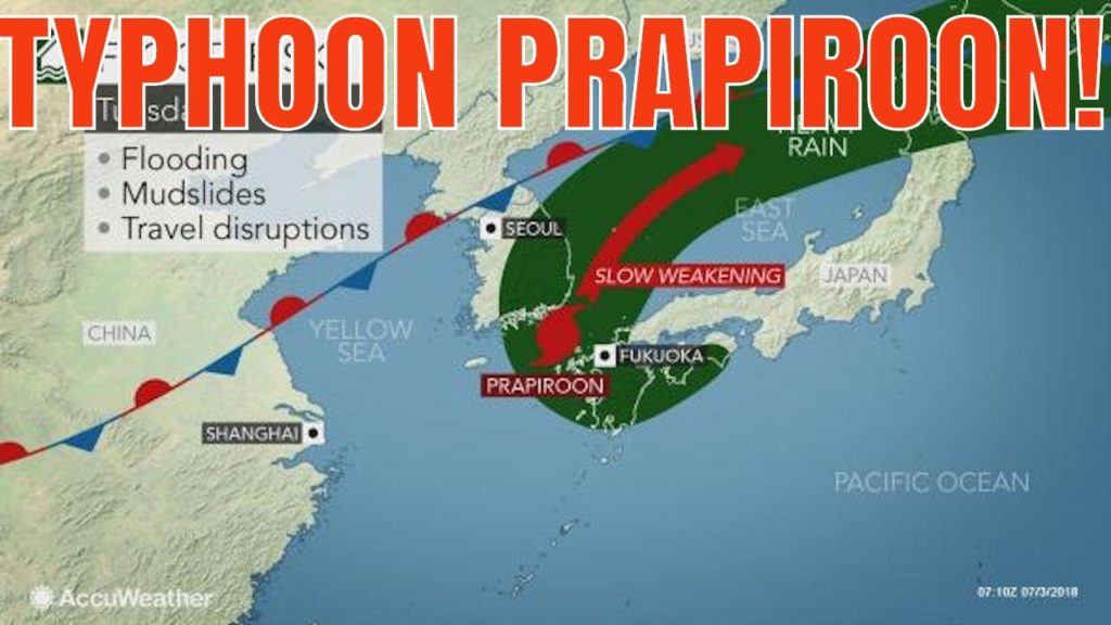
Typhoon Prapiroon will bring potentially flooding rain and strong wind to southern Japan and South Korea during the beginning of the week.
On Monday morning, local time, Parapiroon strengthened from a severe tropical storm to a cyclone as it approached South Korea.
Prapiroon passed just to the south and west of Okinawa on Sunday evening, local time, bringing wind gusts to 96 km/h (60 mph).
After leaving the Ryukyu Islands, Prapiroon will set its sights on the Korean Peninsula and southern Japan.
“Prior to the arrival of Prapiroon, South Korea will endure locally heavy rainfall through Monday as a frontal boundary stalls over the region,” said AccuWeather Senior Meteorologist Adam Douty.
These rounds of rain, in addition to impacts from Prapiroon, will set the stage for flooding and an elevated risk for mudslides.
While Prapiroon will not reach South Korea until Monday night, heavy rain has already begun to fall across the country.
Moisture from Prapiroon is bring pulled northward into the frontal boundary sitting across the Korean Peninsula, further enhancing the ongoing rainfall.
The worst impacts from the storm in South Korea and southern Japan will be felt on Monday night and Tuesday as the tropical cyclone tracks near the southern coast of mainland South Korea and just to the north of Kyushu.
While Prapiroon has strengthend into a typhoon, it is expected to begin weakening prior to reaching South Korea.
As a result, the southern coast of South Korea and western Kyushu will endure the strongest winds with six to 12 hours of tropical-storm-force winds expected from Monday night into Tuesday. This will result in power outages, tree damage and travel disruption.
Due to Prapiroon’s weakening, the risk for any widespread damaging winds elsewhere across the Korean Peninsula and southern Japan will be low.
“Conditions will improve across South Korea and southern Japan on Tuesday evening, but scattered downpours may continue to threaten flooding,” said Douty.
Despite Prapiroon leaving, additional rounds of rain and thunderstorms are expected during the second half of the week across Japan as another frontal boundary stalls across the region, continuing the threat for localized flooding. Heavy rain can soak communities in Kyushu, Shikoku and southern Honshu.
Remember to Share Like and Subscribe! Please leave a comment below! I would love to hear from you!
Find me on:
Instagram: @QBNTO1
TWITTER: QBNTO1
EMAIL: QBNTO1@gmail.com
Thanks to:
The Attorney That Rides
To my friends in Yomitan who keep me fat & happy with delicious pancakes!
Alex at JOY Housing Address: 〒904-0112 Okinawa Prefecture, Nakagami District, 北谷町浜川117−24 Phone: 098-983-7811
Music by:
Joakim Karud On Facebook and Instagram Music by @joakimkarudmusic
DJ QUADS- More free Music to the people of the internet
The Artist Union: theartistunion.com/tracks/b3431f
Do something nice today: helpoki
They travel every corner of Okinawa to help children and families in need.


AloJapan.com