

From a bus window in Japan’s Northern Alps, the snow can rise far above the roof. At Tateyama’s spring opening in 2022, the operator measured the highest point at 18 meters, or 59 feet. Down at the bottom is an ordinary paved road.
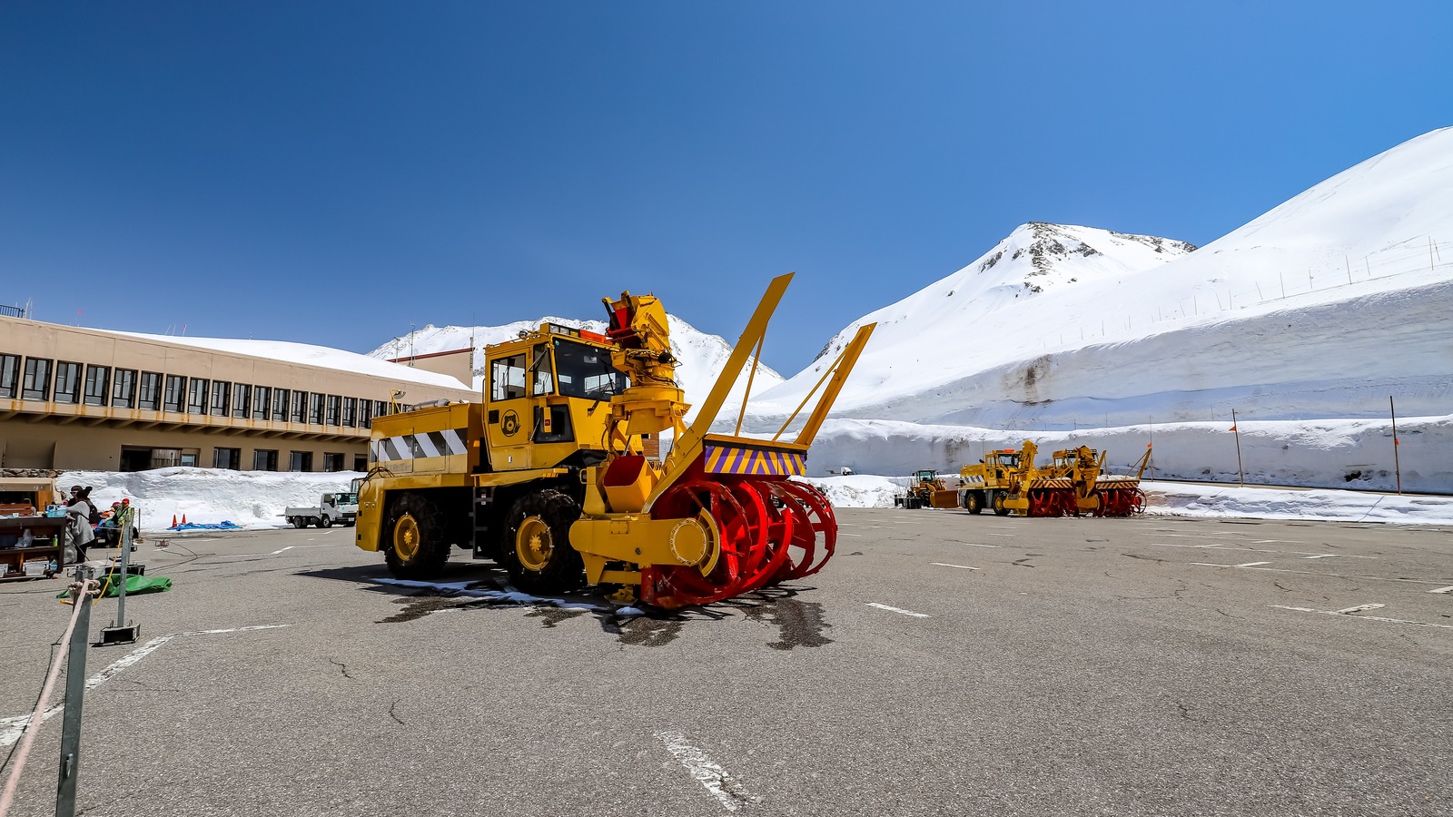
Finding that pavement is the first trick. By the time crews start digging near Murodo, the road can disappear beneath winter drifts. Plow operators use GPS to follow its path and open a passage long enough to walk through. The astonishing part is not how much snow comes out. It is how much they can leave standing.
TRAVEL INSIGHTS & NEWS
Your Week. Your Weekend.
New finds on Monday.
Weekend reads on Thursday.
WELCOME TO DEEP ARRIVAL
You’re Subscribed. Keep Exploring.
Look for Travel Insights & News on Monday and Thursday.
Where In The World
Murodo, Tateyama, Japan; approximate world location
Japan
Murodo, Tateyama
Overview · Natural Earth
59 feetHighest point at the 2021 opening
500 metersLength of the cleared snow corridor
2,450 metersElevation at Murodo
How To Find A Road You Cannot See
Imagine being shown a snowy hillside and asked to point out the center of a two lane road. The usual clues are gone. Edges disappear first, along with whatever contrast might separate asphalt from the slope beyond it. A road on a map still has a path, though. Japan’s national tourism organization describes how plow crews use GPS to help carve out the corridor. That is the connection between the snow in the photograph and the pavement under the bus.
The clearing work and the deep drift make different contributions. Wind and weather leave a substantial pile of snow near the route. People take away the part that stops traffic. They do not need to produce a wall or build it upward. They expose its side by cutting down toward the road surface. What looks like construction in reverse is exactly that: remove enough material in the right place and a canyon appears.
Start looking for the gap at the top rather than the snow at eye level. On a bright day the strip of sky makes it easier to notice how the wall bends with the pavement. Where the road curves, the opening above it curves too. The road is familiar geometry; the height of everything around it makes that familiar shape feel strange.
How A Drift Becomes A Corridor01 / Follow The Buried Line
The plow crews have a known route to follow, even when they cannot see the asphalt. GPS helps turn the map back into a path on the ground. That keeps the work tied to the road that vehicles will actually use.
02 / Take Out The Middle
Clearing away the snow above the pavement leaves the deeper accumulation on either side. A photograph of the finished corridor shows the result of excavation, not a wall built by stacking snow.
03 / Look For The Bend
The best clue that this is a road is the curve. Follow the pavement and the edge of the snow up to the sky. Both lines turn because the cut follows the same route the bus does.
The snow and the road make different contributions to the final shape.
Why The Wall Is Here, And Why It Changes
Murodo sits about 2,450 meters above sea level. The national tourism organization describes this part of the mountains as a place where snow piles into drifts. A drift concentrates snow in one spot. That matters when you see a very tall cut beside the road: you are seeing how much accumulated at this particular place, not the depth of a uniform blanket across the Alps.
The cleared corridor called Yuki no Otani extends about 500 meters near Murodo. The highest point is just that, a point along the walk. One section can dominate the view while another gives you a much better look at the wider mountain setting. When the wall sinks low enough to see more of the ridge, the road stops feeling quite so enclosed. That transition is part of the walk, too.
The operator’s published opening measurements list 14 meters in 2021, 18 in 2022, 13 in 2023 and 16 in 2025. Those figures describe individual openings. Warm weather changes the wall as the season goes on.
What Changes When You Get Out Of The Bus
From the bus, its roofline gives the walls a familiar scale. The walking corridor gives you more time to see how the height changes along the cut.
Even when a walking area is available, bus service and pedestrian access are different decisions. The road may be part of an operating route while an outdoor attraction has its own hours or weather restrictions. Check the operator’s current information for both. If the wall walk is the reason for the trip, verify it separately instead of treating the transport timetable as a guarantee.
Pick A Side Of The Mountains First
From the Toyama side, the national tourism organization describes a sequence of train, cable car and highland bus to Murodo. The bus makes the snow corridor part of the approach. From the Nagano side, Ogizawa is the other entry point to the wider route, with a different set of transfers before you get to Murodo. Decide whether the attraction is the snow wall itself or the experience of crossing the mountains. Those are different days to plan.
An out and back from one side lets you return to the same bed and avoids moving luggage across the route. A crossing can make sense if your next stop is already on the other side. In either case, work backward from the final connection that matters to you. That is a better way to judge whether you have time to walk at Murodo than counting on the route map’s apparent compactness. The map leaves out the waiting between rides.
Use our Japan timing guide for the rest of your trip. If you are comparing a separate mountain stop, our Mount Fuji base guide explains how to choose a starting point. In Shikoku, the Iya vine bridge offers another view of what it takes to reopen a route through a changing landscape.
The Trade You Make By Going Later
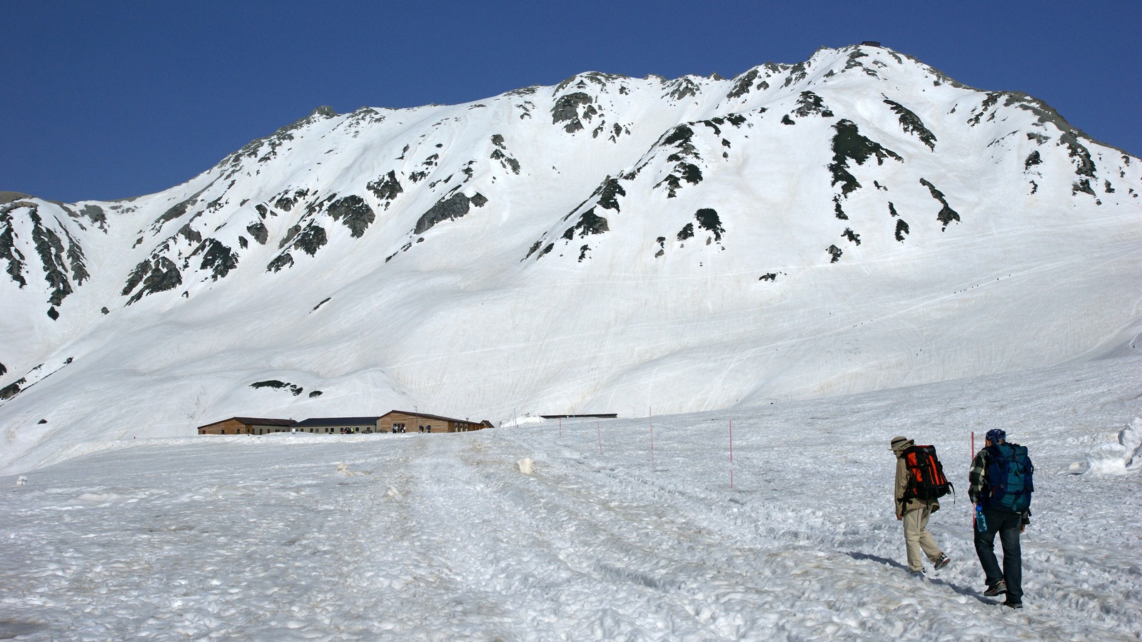
People hoping for the tallest walls have a reason to look at the opening part of the season. People who would rather stand outside in somewhat milder weather may prefer to look later. The official tourism guidance presents both possibilities, rather than naming one perfect week. It also says to check the latest details. At this elevation a spring date on your calendar is no substitute for checking mountain conditions.
It helps to separate what you can choose from what you cannot. You can choose shoes suitable for wet pavement, bring a layer you can put on at the terminal, and leave time for a slower transfer. You cannot reserve blue sky, an unobstructed view or a wall as high as the one in a particular photograph. Build a trip that works if you spend less time outdoors than you hoped.
Three Checks Before You Buy A Ticket01 / Choose A Direction
Pick Toyama or Ogizawa as your starting side, then map the ride to Murodo. For a crossing, verify the connection you need at the far end as well as the ride you take first.
02 / Check The Walk Separately
Look for the operator’s information about the pedestrian section as well as the transit timetable. A ride on the route and a chance to walk alongside the snow are different experiences, and weather can affect them differently.
03 / Keep Time At Murodo
Give yourself room to look around before the return trip. If visibility drops or the walk is unavailable, decide whether the transport and mountain setting alone are enough to make the visit worthwhile.
Start with the experience you want, then fit the transfers around it.
What To Notice Before You Leave
When you are back beside the bus, look away from the tallest wall for a moment. The plow, the pavement and the next bend are the parts you would probably ignore on an ordinary trip. Here they explain the photograph. Snow alone made a drift; a cut along a road made the view possible. The particular opening you walk through is the result of those two things meeting that spring.
Keep Exploring
Places & Wonders
Explore All Places & Wonders ›
AloJapan.com