
, # 5")
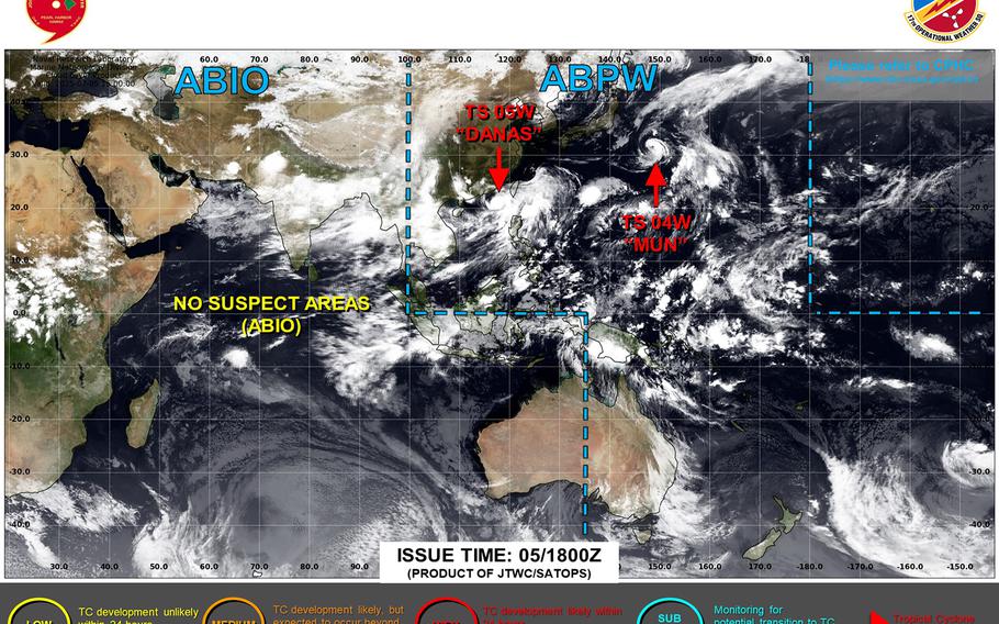
Danas upgraded to a Category 1-equivalent typhoon. Joint Typhoon Warning Center’s latest track continues to keep Okinawa well out of Danas’ forecast path. (Joint Typhoon Warning Center)
5:15 a.m. Sunday, July 6, Japan time: Danas has been upgraded to a Category 1-equivalent typhoon by Joint Typhoon Warning Center. Its latest forecast track continues to keep Danas well west of Okinawa, though at least some solutions are wavering a bit.
At 3 a.m., Danas was about 350 miles southwest of Taipei, Taiwan’s capital, and 710 west-southwest of Kadena Air Base, crawling north-northeast at 4 mph, packing 75-mph sustained winds and 92-mph gusts at center.
U.S. bases on Okinawa remained in seasonal Tropical Cyclone Condition of Readiness 4 overnight Saturday. Standby Signal 1 remains raised by the Hong Kong Observatory. A typhoon warning is up for about half of Taiwan’s provinces, south and coastal areas, according to Central Weather Bureau.
If Danas continues on present course, JTWC projects it to pick up forward speed as it skims Taiwan’s west coast.
It’s forecast to peak at 92-mph sustained winds and 115-mph gusts at mid-afternoon Sunday and pass about 360 miles west of Kadena around midnight Monday before curving west and burrowing into the China coast, about 235 miles south of Shanghai at mid-afternoon Tuesday.
Expect heavy rain associated with the system as it skirts Taiwan’s west coast. Okinawa can expect afternoon showers and possible thunderstorms as the new week unfolds.
AloJapan.com