Location: Ashinoko Skyline, Shizuoka, Japan Timestamps: 16:11 on February 14, 2024
Pentax K-1 II + DFA 28-105mm F3.5-5.6 + CP 80 mm ISO 100 for 1/60 sec. at ƒ/8.0
Nestled at an elevation of 723 m (2,372 ft) within Mt. Hakone, Ashinoko Lake, or Lake Ashi, stands as Kanagawa Prefecture’s largest lake. Hakone, a former checkpoint on the Tokaido Road connecting Kyoto to Edo (modern-day Tokyo). The area surrounding Ashinoko Lake are rich with cultural sites, stunning views, and a blend of traditional ryokans, modern hotels, art museums, and hot spring resorts.
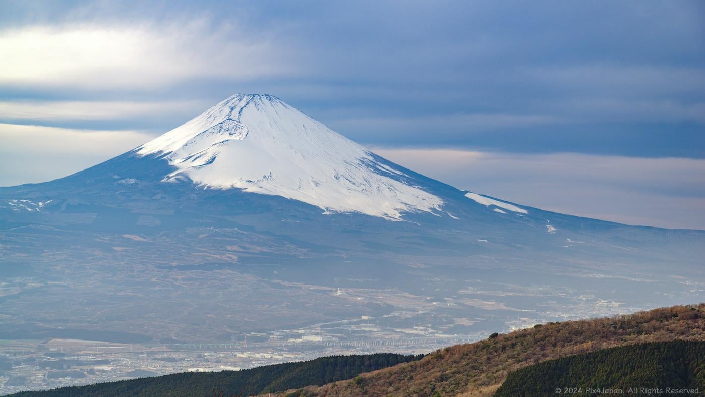
One of my favorite highlights in Hakone is the Ashinoko Skyline, a scenic highland drive 300 meters above Ashinoko Lake tracing the outer rim of the Hakone caldera, providing mesmerizing views of Ashinoko Lake and Mt. Fuji.
As you navigate the Ashinoko Skyline toll road, discover captivating rest areas like Shakushi-toge Pass, offering an unobstructed panoramic view of Mt. Fuji and the valley below.
Just north of the Shakushi-toge Pass, a so-called “melody road” awaits you. For a short stretch, drive at 40 kph and the grooves in the road generate vibrations, producing melodies such as the Japanese folk song “Fuji no Yama.” If you make a U-turn and head south, you’ll be able to hear the tune of “A Cruel Angel’s Thesis” from the anime “Neon Genesis Evangelion.” Just be sure to roll up your car windows so that you can hear the
If you plan on visiting the Ashinoko Skyline, try to schedule your drive during winter when the dry air offers the clearest views of Mt. Fuji. In contrast, summer brings morning fog and afternoon clouds, limiting the number of days when the iconic peak is visible.
For a deeper dive into the geological and cultural history of Lake Ashi, along with Google Maps links and references, check out the full write-up – a quick 2-minute read (line in Profile).

1 Comment
Location: Ashinoko Skyline, Shizuoka, Japan
Timestamps: 16:11 on February 14, 2024
Pentax K-1 II + DFA 28-105mm F3.5-5.6 + CP
80 mm ISO 100 for 1/60 sec. at ƒ/8.0
Nestled at an elevation of 723 m (2,372 ft) within Mt. Hakone, Ashinoko Lake, or Lake Ashi, stands as Kanagawa Prefecture’s largest lake. Hakone, a former checkpoint on the Tokaido Road connecting Kyoto to Edo (modern-day Tokyo). The area surrounding Ashinoko Lake are rich with cultural sites, stunning views, and a blend of traditional ryokans, modern hotels, art museums, and hot spring resorts.
One of my favorite highlights in Hakone is the Ashinoko Skyline, a scenic highland drive 300 meters above Ashinoko Lake tracing the outer rim of the Hakone caldera, providing mesmerizing views of Ashinoko Lake and Mt. Fuji.
As you navigate the Ashinoko Skyline toll road, discover captivating rest areas like Shakushi-toge Pass, offering an unobstructed panoramic view of Mt. Fuji and the valley below.
Just north of the Shakushi-toge Pass, a so-called “melody road” awaits you. For a short stretch, drive at 40 kph and the grooves in the road generate vibrations, producing melodies such as the Japanese folk song “Fuji no Yama.” If you make a U-turn and head south, you’ll be able to hear the tune of “A Cruel Angel’s Thesis” from the anime “Neon Genesis Evangelion.” Just be sure to roll up your car windows so that you can hear the
If you plan on visiting the Ashinoko Skyline, try to schedule your drive during winter when the dry air offers the clearest views of Mt. Fuji. In contrast, summer brings morning fog and afternoon clouds, limiting the number of days when the iconic peak is visible.
For a deeper dive into the geological and cultural history of Lake Ashi, along with Google Maps links and references, check out the full write-up – a quick 2-minute read (line in Profile).