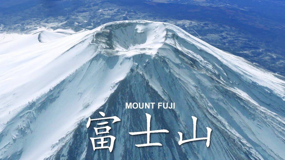
Fly over Mount Fuji 富士山. Mount Fuji summit view. Fujisan Japan.
Mount Fuji 富士山 Fujisan, Fugaku, located on the island of Honshū, is the highest mountain in Japan, with a summit elevation of 3,776.24 m (12,389 ft 3 in). It is the second-highest volcano located on an island in Asia (after Mount Kerinci on the island of Sumatra), and seventh-highest peak of an island on Earth. Mount Fuji is an active stratovolcano that last erupted from 1707 to 1708. The mountain is located about 100 km (62 mi) southwest of Tokyo and is visible from there on clear days. Mount Fuji’s exceptionally symmetrical cone, which is covered in snow for about five months of the year, is commonly used as a cultural icon of Japan and it is frequently depicted in art and photography, as well as visited by sightseers and climbers.
Mount Fuji is one of Japan’s “Three Holy Mountains” 三霊山 along with Mount Tate and Mount Haku. It is a Special Place of Scenic Beauty and one of Japan’s Historic Sites. It was added to the World Heritage List as a Cultural Site on June 22, 2013. According to UNESCO, Mount Fuji has “inspired artists and poets and been the object of pilgrimage for centuries”. UNESCO recognizes 25 sites of cultural interest within the Mount Fuji locality. These 25 locations include the mountain and the Shinto shrine, Fujisan Hongū Sengen Taisha.
Mount Fuji is a very distinctive feature of the geography of Japan. It stands 3,776.24 m (12,389 ft) tall and is located near the Pacific coast of central Honshu, just southwest of Tokyo. It straddles the boundary of Shizuoka and Yamanashi Prefectures. Four small cities surround it: Gotemba to the east, Fujiyoshida to the north, Fujinomiya to the southwest, and Fuji to the south. It is surrounded by five lakes: Lake Kawaguchi, Lake Yamanaka, Lake Sai, Lake Motosu and Lake Shōji. They, and nearby Lake Ashi, provide views of the mountain. The mountain is part of the Fuji-Hakone-Izu National Park. It can be seen more distantly from Yokohama, Tokyo, and sometimes as far as Chiba, Saitama, Tochigi, Ibaraki and Lake Hamana when the sky is clear. It has been photographed from space during a space shuttle mission.
富士山 富士山 富岳は本州に位置し、標高 3,776.24 m (12,389 フィート 3 インチ) の日本で最も高い山です。 アジアの島にある火山としては 2 番目に高く (スマトラ島のケリンチ山に次ぐ)、地球上で 7 番目に高い島です。 富士山は、1707 年から 1708 年にかけて最後に噴火した活発な成層火山です。富士山は東京の南西約 100 km (62 マイル) に位置し、晴れた日にはそこから見ることができます。 富士山の非常に対称的な円錐形は、1 年のうち約 5 か月間雪に覆われ、日本の文化的アイコンとして一般的に使用されており、観光客や登山者が訪れるだけでなく、アートや写真にも頻繁に描かれています。
富士山は立山、白山と並んで日本三霊山と呼ばれる三霊山です。 国の特別名勝であり、国の史跡の一つです。 2013 年 6 月 22 日に文化遺産として世界遺産に登録されました。ユネスコによると、富士山は「芸術家や詩人にインスピレーションを与え、何世紀にもわたって巡礼の対象となってきました」。 ユネスコは、富士山地域内の文化的関心のある 25 のサイトを認識しています。 この 25 か所には、山と神社、富士山本宮浅間大社が含まれます。
富士山は日本の地理の非常に特徴的な特徴です。 高さ 3,776.24 m (12,389 フィート) で、東京のすぐ南西、本州中部の太平洋岸近くに位置しています。 静岡県と山梨県の県境です。 東に御殿場市、北に富士吉田市、南西に富士宮市、南に富士市の 4 つの小さな都市が周辺を囲んでいます。 周囲を河口湖、山中湖、西湖、本栖湖、精進湖の5つの湖に囲まれています。 彼らと近くの芦ノ湖からは、山の景色を眺めることができます。 山は富士箱根伊豆国立公園の一部です。 横浜や東京から遠く、空が澄んでいると千葉、埼玉、栃木、茨城、浜名湖まで見えることもあります。 スペースシャトルのミッション中に宇宙から撮影されました。

