BECOME MY PATRON!
Support the creation of the next episodes on Patreon!
—————————————————————————————–
Bicycle touring Iran, Out of the beaten track, out of the beaten path.
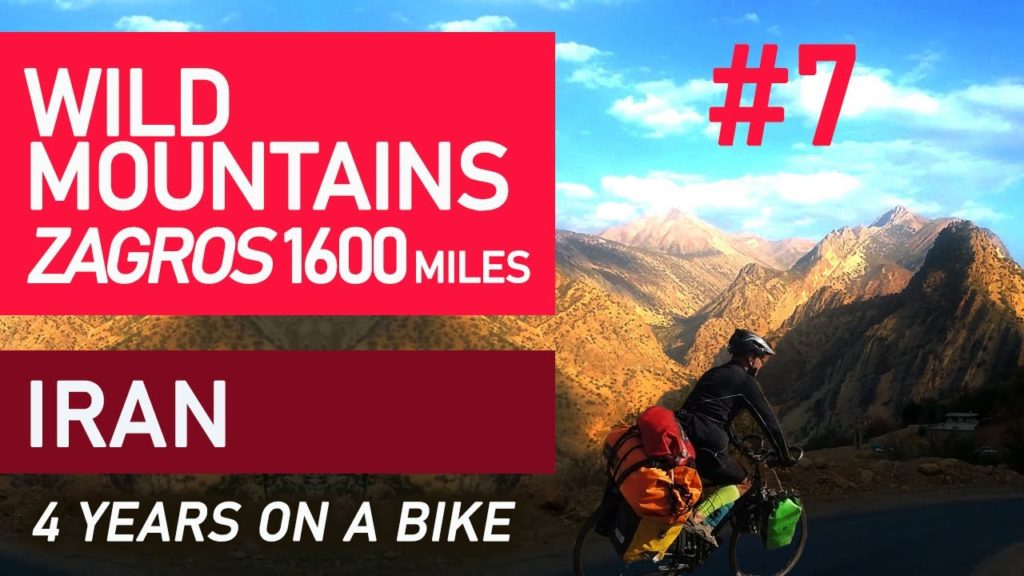
I didn’t escape from the mountains before the sunset and an old car with inoperable brakes took me. We hit the back of another car. Smoke escaped from the engine and there would be no escape in the event of a gas explosion because my door was blocked. Luckily, I had seatbelts fastened by a driver, which advised me against fastening. I feel their violent grip for now. Today’s traffic accident was like a cherry on the cake after a meditative ride amid the silence of sandy red mountains with rarely appearing stone houses. Bicycle touring in Iran
Bicycle touring the Zagros Mountains. Iran.
accommodating, bestowing, billeting, bivouacking, boarding, bunking, chambering, domiciling, encamping, harboring, housing, lodging, putting up, quartering, roofing, rooming, sheltering, taking in, camping. Excursion, expedition.
Bikepacking – traveling on a bike taking what you need with you.
Voyaging, trekking, wanderlust, Voyage, globe-trotting, voyaging.
Zagros – mountains in Iran, south-west facing they border the Iranian Plateau. 1600 km long, 200-300 km wide. The highest peak, Zard Kuh, 4548 m above sea level They include several mountain ridges (running parallel from the north-west to the south-east) separated by longitudinal depressions of tectonic and karst origin. Ridges with flat tops and steep slopes.
Folded in Alpine orogeny. Constructed of Mesozoic slate and limestones, as well as limestones and Tertiary flysch. Frequent earthquakes. Developed karst phenomena. Salt marshes and lakes in the valleys. Forestless foothills. Above 2,500 m above sea level there are deciduous forests (oaks, elms and ash), as well as shrubs of the maquis type. Above, there are dwarf trees and alpine meadows. At an altitude of over 4,000 meters above sea level there are eternal snow and small ice sheets. At the foot, rich oil deposits. Bicycle touring Iran,
The Zāgros stretches for about 1500 km from the province of Kordestān on the Iraqi border to the Strait of Hormuz, where the Middle East and the Arabian Peninsula approach each other for 50 km. The mountains run roughly parallel to the alluvial land of the Tigris or the Persian Gulf at a distance of 50–100 km and are 200 to 300 km wide in several mountain ranges. Out of the beaten track,
The highest peaks reach an altitude of over 4400 m near the city of Isfahan, while they are about 1000 m lower to the south near Shiraz.
The Kel-i-Schin pass between Rawanduz (Iraq) and Miandoab in Iran is the only pass through the northern part of the Zagros. out of the beaten path.
The Zagros Mountains were formed in the course of the Alpidian Orogeny by the collision of two continental plates – the Eurasian and the Arabian plate. Current GPS measurements [1] in Iran have shown that this collision is still active. The resulting deformation is not evenly distributed in Iran, but mainly found in the great mountain ranges of the Elbe and the Zagros. Bicycle touring. Voyaging, trekking, wanderlust, Voyage, globe-trotting, voyaging
A relatively dense GPS-supported network covering the Zagros in the Iranian part also proves a high deformation within the Zagros. [2] The measurements show that the current rate of shortening in the southeastern part of the Zagros is ~ 10 mm / a and in the northwestern part ~ 5 mm / a. These two zones of different deformations are separated by the Kazerun Fault. The GPS results also indicate different foreshortening directions along the mountain range, i.e. H. normal shortening in the southeast and oblique shortening in northwestern Zagros.
The sediment cover of the Zagros lies in the southeast on a layer of rock salt, while in the northwest there is no or only a very thin layer of salt.
Tensions in the earth’s crust from the collision caused extensive folding of the existing layered sedimentary rocks. Subsequent erosion removed soft rocks such as mudstone and siltstone. Harder rocks such as limestone (calcium-rich rock, consisting of the remains of marine organisms) and dolomite (rocks similar to limestone, contains calcium and magnesium) remained. This differential erosion formed the straight ridges of the Zagros Mountains.
Voyage, globe-trotting, Voyaging, trekking, wanderlust. Backpacking and bikepacking.
The mountains are divided into many parallel mountain ranges (up to 10 or 250 km wide) and are the same age as the Alps. The main oil fields of Iran are in the western central foothills of the Zagros Mountains. The southern areas of Fars Province have slightly lower peaks (up to 4000 meters). Bicycle touring.


AloJapan.com