#पुरंदर_किल्ला #Purandar_fort #Pune_tourism
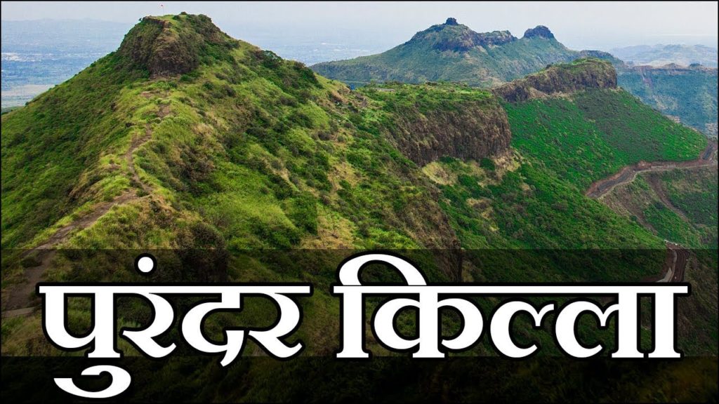
पुरंदर किल्ला Purandar Fort – पुरंदर किल्ल्याची उंची १५०० मीटर असुन हा किल्ला गिरीदुर्ग प्रकारात मोडतो. पुणे जिल्ह्यातील विस्तिर्ण डोंगर रांगेत हा किल्ला असुन ट्रेक च्या दृष्टीने अतिशय सोपा आहे.
सह्याद्रीच्या दक्षिणोत्तर पसरलेल्या मूळ रांगेतून काही फाटे पूर्व दिशेकडे फुटले आहेत. त्यापैकी एका फाट्यावर सिंहगड आहे. तोच फाटा तसाच पूर्वेकडे अदमासे २४ कि.मी. धावून भुलेश्वर जवळ लोप पावतो. याच डोंगररांगेवर पुरंदर, वज्रगडा वसलेला आहे. कात्रज घाट, बापदेव घाट, दिवे घाट हे तीन घाटा ओलांडून पुरंदरच्या पायथ्याशी जाता येते. किल्ल्याला चौफेर माच्या आहेत. किल्ल्याचे स्थान १८.१८ अंश अक्षांश व ७४.३३ अंश रेखांश वर स्थित आहे. किल्ला पुण्याच्या आग्नेय दिशेला अंदाजे २० मैलांवर तर सासवडच्या नैऋत्येला ६ मैलावर आहे. गडाच्या पूर्वेला बहुतांशी प्रदेश सपाट आहे तर पश्चिमेला डोंगराळ प्रदेश आहे. वायव्येला १३-१४ मैलांवर सिंहगड आहे तर पश्चिमेला १९-२० मैलांवर राजगड आहे. पुरंद्र किल्ला तसा विस्ताराने मोठा आहे. किल्ला मजबूत असून बचावाला जागा उत्तम आहे. गडावर मोठी शिबंदी राहू शकते. दारूगोळा व धान्याचा मोठा साठा करून गड दीर्घकाळ लढवता येऊ शकत असे. एक बाजू सोडली तर गडाच्या इतर सर्व बाजू दुर्गम आहेत. गडावरून सभोवारच्या प्रदेशावर बारीक नजर ठेवता येते.
Purandar Fort figures repeatedly in the rising of Shivaji against the Adil Shahi Bijapur Sultanate and the Mughals. Purandhar fort stands 4,472 ft. above the sea in the Western Ghats, 50 km southeast of Pune ahead of Saswad village
Address: Purandar Rd, Gherapurandhar, Maharashtra 412205
Elevation: 4,472 ft (1,363 m)
Hours: Open today · 9AM–5PM
Range: Western Ghats
PURANDAR TREK – This fort stands 4472 ft above sea level and is located near Narayanpur. The stucture of the fort is just amazing.
Routes: From pune the easiest way is to go towards Saswad via Hadapsar and then a diversion from Narayanpur leads you to the fort. There’s a slight chance that you might get confused near Narayanpur. The locals at Narayanpur can help you with the directions.
Difficulty Level and Other useful tips: Difficulty level is Medium. It will take approximately 2 1/2 hours to reach to the top.There’s a motorable road which will take you to the mid of the fort. From there it hardly takes 45 mins to go to the top. If you don’t want to go by the motorable road you can park your vehicles at the base and trek from the base itself.Make sure that you carry enough water with you. Dehydration can be a serious killer.
#fort #killa #किल्ला #गड #gadkille #पर्यटन #sambhaji_maharaj #chatrapati_shivaji_maharaj #battle #tourism #purandar #army_camp
Follow me on:-
facebook :
Instagram :
Amazon :
YouTube :
Blogger :
Twitter :
If you like the video, don’t forget to LIKE, SHARE, SUBSCRIBE, COMMENT.
Music Credit – Distrion & Alex Skrindo – Entropy [NCS Release]
SoundCloud_
All background Music used can be found on NoCopyrightSounds.


AloJapan.com