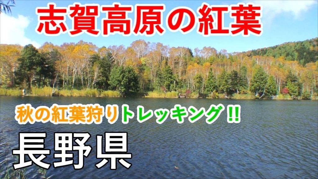
志賀高原(しがこうげん)は、長野県北東部に位置し、多数の美しい池沼や高層湿原が点在する高原で、絶好のトレッキングスポットです。例えば「池巡りコース」など森林浴も楽しみながら池と湿原を散策できる多様なハイキングコースが整備されています。群馬県の草津白根山とも隣接しており、山岳・高原風景を存分に満喫できるスポットです。
今回は志賀高原の絶景トレッキングコースの中から、木戸池・田ノ原湿原コースと四十八池・大沼池コースをご紹介します。
木戸池(きどいけ)は、志賀高原の田ノ原湿原のすぐ南方にある池で、志賀草津道路 (国道292号)沿いに位置し、志賀高原でアクセスがもっとも容易な池の一つです。池の周りを1周できる散策道が整備されており、湖畔には温泉旅館もあります。
田ノ原湿原(たのはらしつげん)は、志賀高原のやや南方にある高層湿原で、志賀草津道路 (国道292号)沿いに駐車場もあり、トレッキングの拠点として便利です。散策道を通って南方の丘を越えると志賀高原のシンボルである「笠ヶ岳」や「木戸池」も見えます。
渋池(しぶいけ)は、志賀高原にある池の一つで、志賀草津道路 (国道292号)沿いの「硯川バス停」から「前山リフト」で登ったすぐ先に位置しています。四十八池や大沼池を巡る際の池めぐりトレッキングコース上にあり、湖畔に展望スペースも設けられていて、散策の休憩地点としてもよい場所です。
四十八池(しじゅうはちいけ)は、志賀高原のやや奥地にある高層湿原とそこに点在する大小様々な池塘群の総称で、湿原の中を木道が通っており、池を巡ることができます。よく晴れた日には志賀山の眺めも良く、大小60もの池塘が点在し、爽やかな高原風景を満喫できるスポットです。
大沼池(おおぬまいけ)は、志賀高原の奥地にある大きな池で、志賀高原で最大の面積をもつ池です。大沼池に行くにはちょっと気合を入れたトレッキングになりますが、途中の行程も「四十八池」を通るコースなどは見所が多く、森林浴も満喫できます。
志賀高原へのアクセスは、長野県と群馬県にまたがる「志賀草津道路」(国道292号)を利用します。主要な散策スポット近くに駐車場が整備されていますので、目的のトレッキングコースに便利な駐車場を利用します。池めぐりコースの場合は前山リフトの駐車場が便利です。
Shiga Kogen is located in the northeastern part of Nagano Prefecture, and is a plateau dotted with many beautiful ponds and marshes, making it a great spot for trekking. For example, there are various hiking courses such as the “Pond Tour Course” where you can enjoy a walk through the ponds and marshlands while taking a forest bath.
Shiga Kogen is adjacent to Mount Kusatsu-Shiranesan in Gunma Prefecture, and is a spot where you can fully enjoy the mountain and highland scenery.
Kidoike Pond is located just south of Tanohara Marshland in Shiga Kogen and is one of the easiest ponds in Shiga Kogen to access along Shiga-Kusatsu Road (Route 292). There is a walking path around the pond, and there are hot spring inns by the lake.
Tanohara Marshland is a high-rise marshland located slightly to the south of Shiga Kogen, with a parking lot along Shiga-Kusatsu Road (Route 292), making it a convenient base for trekking. If you take the walking path and go over the hill to the south, you can see Kasagatake, the symbol of Shiga Kogen, and Kidoike.
Shibuike Pond is one of the ponds in Shiga Highlands, and is located just beyond the Maeyama Lift from the Suzurikawa stop It is located on the trekking course for touring around 48 ponds and Onuma Pond, and with an observation deck by the lake, it is a good place to take a break for a walk.
Shijuhachiike (“48 Pond”) is a generic term for the high-rise marshland located in the depths of Shiga Highlands and the various pond-tanggs of various sizes scattered there. On a clear day, you can enjoy the view of Mt. Shiga and 60 large and small pond-tang dotted around the area, so you can enjoy a refreshing highland scenery.
Onuma Pond is located deep in Shiga Kogen, and is the largest pond in Shiga Kogen. It’s a bit of a strenuous trek to get to Onumaike, but there are many places to see on the way to Onumaike, such as the course that passes through “48 Pond”, where you can fully enjoy forest bathing.
<動画の内容とタイム・インデックス>
0:00 地図
0:17 志賀高原の概要と木戸池
1:05 田ノ原湿原
1:59 笠ヶ岳(志賀高原のシンボル)
3:08 渋池(池めぐりコースの起点)
3:31 四十八池
4:43 大沼池
【日本の紅葉絶景!】シリーズは、日本全国の紅葉名所を徹底的にご紹介します!「秋」が深まる日本列島。雄大な山岳風景や湖沼・滝など、華やかに彩る秋の風物詩「紅葉」の風景を存分にご堪能ください。
・日本の紅葉絶景! HD長編シリーズ 再生リスト
・長野県北部の映像素材の一覧は、以下のページをご参照ください。
(業務用途での利用が可能な映像素材も提供しています)
・志賀高原の観光ガイド(癒しの国 日本.TV)
・志賀高原トレッキングマップ
・チャンネル登録をお願いします ↓
#志賀高原 #木戸池 #大沼池 #紅葉絶景


AloJapan.com