Thank you for watching! We publish videos daily from Japan.
If you like them, please consider subscribing to our channel.
Youtube:
Twitter:
Instagram:
Youtube:
00:38 Kamogawa City
19:01 Oyama Senmaida Terraced Rice Fields
About Kamogawa City
Kamogawa (鴨川市, Kamogawa-shi) is a city located in Chiba Prefecture, Japan.
As of March 2017, the city had an estimated population of 33,307, and a population density of 175 persons per km². The total area is 191.14 km².
The name of the city consists of two kanji characters: the first, kamo (鴨), meaning “duck”, and the second, kawa (川), meaning “river”.
Kamogawa is near the southeastern tip of the Bōsō Peninsula, facing the Pacific Ocean, about 70 km south of the prefectural capital, Chiba City, and about 85 km from the capital of Japan, Tokyo. The area has a warm maritime climate with hot summers and mild winters. Kamogawa is home to Mount Atago, which at 408.2 m (1,339 ft) is the highest point in Chiba Prefecture. Mount Kiyosumi (337 m (1,106 ft)) is home to Seichōji. The Kamo River (22.25 kilometres (13.83 mi)) empties into the Pacific Ocean at Kamogawa.
The area of present-day Kamogawa was part of ancient Awa Province. Nichiren (1222 – 1282) was born in the Kominato district of Kamogawa, and his birthplace is commemorated at Tanjō-ji. During the Edo period, it was mostly tenryō territory controlled directly by the Tokugawa shogunate, with portions under the control of the feudal domains of Funagata Domain, Tateyama Domain, Iwasuki Domain and Tsurumaki Domain.[3] The short-lived (1638-1690) Tōjō Domain and the Bakumatsu period Hanabusa Domain were also located within the borders of modern Kamogawa.
In 1877, ten years after the beginning of the Meiji era, Kamogawa suffered a notable cholera outbreak. In 1927 Awa-Kamogawa Station became the terminus of both the Sotobō Line and the Uchibō Line. The city sustained injuries and fatalities during World War II via aerial bombing by the United States. The city was occupied by American forces after the war. Soon after, land reform and economic reform were carried out in Kamogawa. In 1958 the coastal areas of Kamogawa became a part of Minami Bōsō Quasi-National Park, and the town became a tourist destination as a result of the establishment of the park.
Kamogawa serves as a commercial center for the surrounding region of south-central Chiba Prefecture. Commercial fishing remains the primary industry in Kamogawa, which has five active fishing ports. The city is noted for its sardine and mackerel production. Rice farming and floriculture are practiced. The tourist industry is a growing component of the local economy, with visitors attracted to the area’s beaches, hot spring resorts, Kamogawa Seaworld, and the Futomi Flower Center.
At the start of the Meiji period, Kamogawa consisted of all of Nagasa District with two towns and nine villages, and two villages from neighboring Asai District. All of these villages and towns (including Kamogawa Town) became part of Awa District in 1890. Kamogawa was elevated to city status on March 31, 1971.
On February 11, 2005, the town of Amatsukominato (from Awa District) was merged into Kamogawa.
About Oyama Senmaida Terraced Rice Fields
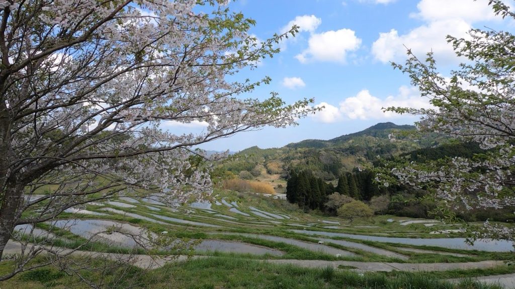
The cultivation of the hillsides of mountainous regions was a common sight throughout Japan, including Kamogawa, until the late 1970s. However, due to the increase in the use of machinery and an aging population of farmers, this landscape is rapidly disappearing. Within Kamogawa, the terraced rice paddies of Oyama Senmaida continue to be carefully maintained and cultivated to this day. The puzzle piece-like fields of the Oyama Senmaida fitting together to create curvy steps up the mountainside, are the very image of Japanese farming villages. Oyama Senmaida was recognized in 2002 as a “cultural landscape,” created mutually by people and nature, when it was designated by Chiba Prefecture as a Prefectural Landmark. Currently, the Oyama Senmaida fields are being maintained by the “owner system,” which works to contribute toward local revitalization by helping to preserve this beautiful landscape and provide a place for urban dwellers to try their hand at farming.
About Oyama Fudo
Located on the slope of Mount Takakura, Oyamadera Temple is said to have been built during the Nara Period. From the temple grounds, you can take in a full view of the Nagasa Plains stretching to the Pacific Ocean.
#StayHome and travel to Japan #WithMe
#iostoacasa


AloJapan.com