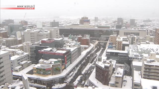
Weather officials in Japan say a winter pressure pattern has caused snow to intensify mainly along the Sea of Japan coast, a condition which is expected to continue through Monday. They are forecasting that some flat areas on the Pacific side of the country, including central Tokyo, may see snow accumulations.
A rapidly developing low-pressure system has caused strong winds mainly in Hokkaido. In the 3 hours through 5 a.m. on Saturday, instantaneous maximum wind speeds of 93.6 kilometers per hour in Kushiro City and 91.44 kilometers per hour in Rausu Town were recorded. The officials are warning people in Hokkaido to be on the alert for blizzards for a few more hours on Saturday.
The Japan Meteorological Agency says a strong cold air mass will flow in due to the intensifying winter pressure pattern. This will likely increase snowfall, even causing accumulations in the Kanto and Kyushu regions, which usually receive little.
Heavy snow is expected to peak on Sunday due to the arrival of an even stronger cold air mass. Snow cloud bands generated by what is known as a Japan Sea polar air mass convergence zone, or JPCZ, may bring rapid increases in snow accumulations over a short period mainly in the northern Kinki region and the Sanin region.
In the 24 hours through Sunday morning, up to 70 centimeters of snow is expected in Niigata Prefecture, 60 centimeters in the Chugoku region and 50 centimeters in the Hokkaido, Hokuriku and Kinki regions.
Officials are calling on people mainly on the Japan Sea side to be cautious about the impact of heavy snow on traffic. They are also urging caution regarding avalanches, blackouts caused by snow on power lines, and snow falling from roofs.


AloJapan.com