

Hakone delivers big views, quiet forests, and historic footpaths without demanding a full itinerary. Here are four trails that show off the region’s best.
(Photo: © Marco Bottigelli via Getty Images)
Updated December 8, 2025 04:20PM
Just an hour from Tokyo, there are mountains that are unexpectedly vast. The wildness in Hakone, Japan, is gentle around its edges, a little muggy, winding, and mysterious — big enough to swallow a day without trying. Coming from the neon crush of Shinjuku, the local train drops you into a landscape that rewards curiosity more than grit, which makes it the perfect outdoor leg of any Tokyo trip. And if you’re like a lot of other travelers in the States right now, you’re eyeing a trip to Japan in 2026: This April, the country registered a historic 3,908,900 visitors, more than in any single month on record.
You don’t need strategy, luck, or any special guide to experience the best of Hakone. This area is layered: ridges, shrines, cedar groves, crowds, and souvenir stands are stacked in a way that feels both dense and calm. It’s compact enough that if you wander, you’ll end up on a worthwhile trail. But, because buses circle the lake and connect most trailheads, it’s easy to build point-to-point days without worrying about getting stranded.
If you want a place to start, I’d try these winners from my trip in October.
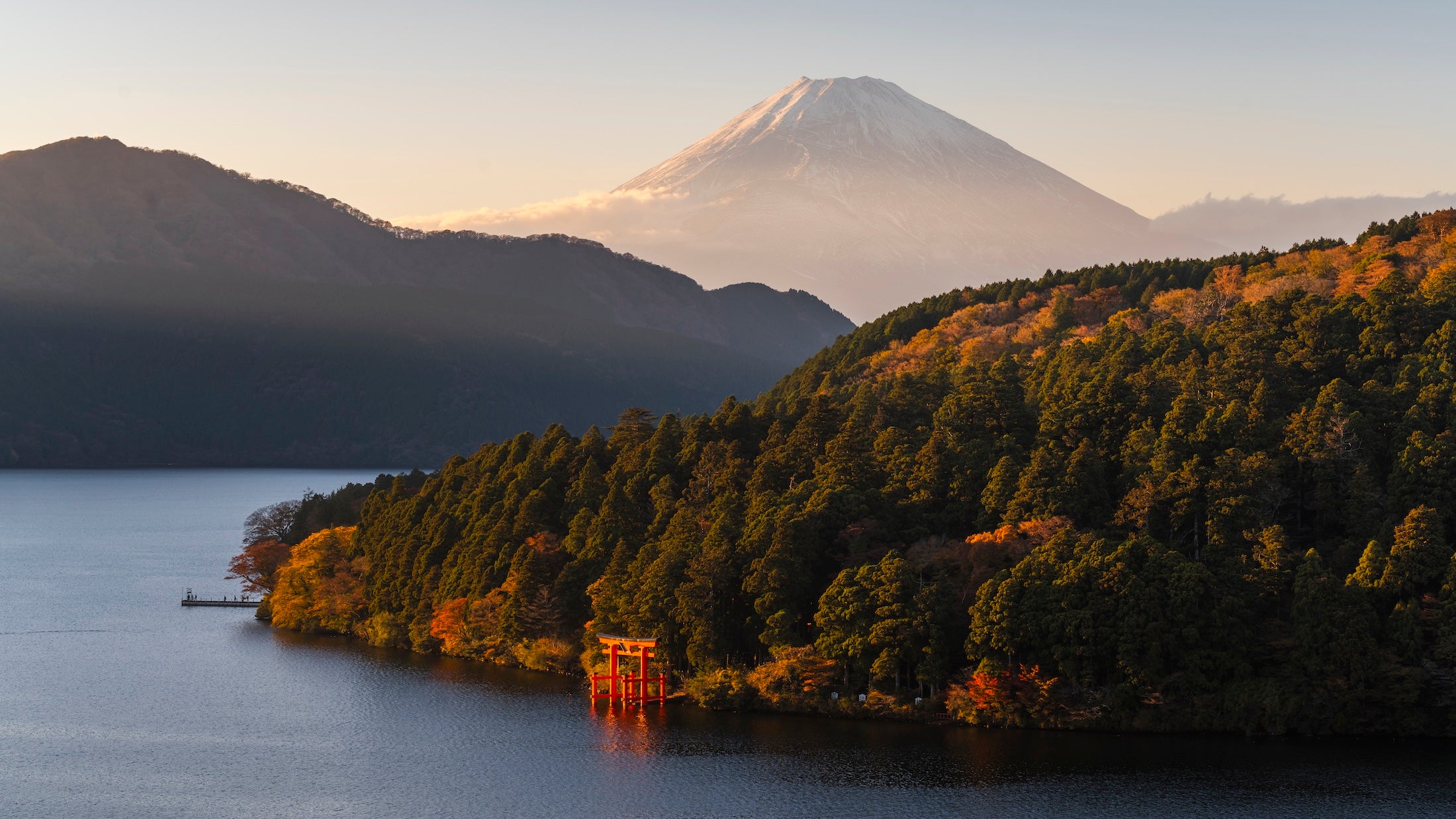
Lake Ashinoko – Mt. Komagatake
If you want a summit without sacrificing the whole day, Mt. Komagatake is an easy win. From the Hakone-en side of Lake Ashinoko, this trail climbs through a thick cedar forest and opens onto a broad, steaming volcanic ridge. It’s the kind of terrain that looks dramatic even when you’re not trying to photograph it.
The hike comes in at about 5.8 miles point-to-point with roughly 2,700 feet of gain if you start near Lake Ashinoko. Most hikers treat it as an out-and-back from the lakeshore, though you can turn it into a point-to-point if you descend toward the ropeway station. On clear days, Fuji hovers nearby, and on wetter ones, the crater rim is eerie and mythic. If you’d rather skip the climb altogether, the Komagatake Ropeway carries you to the summit in minutes, where a mellow loop circumnavigates the top.
To get there: Take the Hakone Tozan Bus to the Hakone-en stop. The Komagatake trailhead and ropeway station sit just above the lakeshore. There is ample signage and easy to follow maps everywhere.
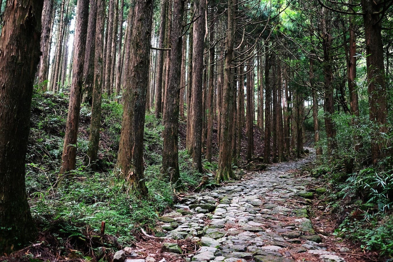
‘Tokaido’ means ‘eastern sea route;’ this pedestrian path was the most significant of the five major routes in Japan during the Edo era (1603–1868). (Photo: Jina Ihm via Getty Images)
Old Tokaido Road: Hakone Sekisho – Hatajuku
If you want a hike with more history than elevation gain, the Old Tokaido Road is it. Dating from the early 1600s, it’s a preserved stretch of the Edo-era highway that once linked Kyoto and Tokyo. From the Hakone Sekisho start, the trail climbs easily over crumbling stones and through cryptomeria groves toward Hatajuku.
This segment runs just under 4 miles one-way, with small, rolling hills rather than an intense summit push. In wet weather, the mossy stones get slick, but that’s part of the appeal: you can feel the age of the road and imagine the many who’ve walked it before. Teahouses, markers, and little roadside shrines appear when you least expect them, and that sense of continuity is what makes the trail special.
To get there: Take the Hakone Tozan Bus to Hakone Sekisho and follow the posted signs for the Tōkaidō. The route is well marked, and you can catch another bus back from Hatajuku when you finish.
Mt. Kintoki Loop
If you want a small hike that feels substantial, Kintoki is a great option. The trail climbs through a thick, muggy forest in a steady, no-nonsense way before breaking onto a bare, windy summit with wide-open views of Fuji. It’s the kind of peak that feels big even though the stats aren’t trying to impress you.
The classic route is about 3.2 miles round-trip with roughly 1,900 feet of gain, climbing steadily from Kintoki Shrine. On busier weekends, a tiny summit hut sells tea and snacks, the sort of nod that makes this feel like a place locals actually go.
To get there: Take the Hakone Tozan Bus to the Kintoki-tozanguchi stop. Trail signs start right at the road.
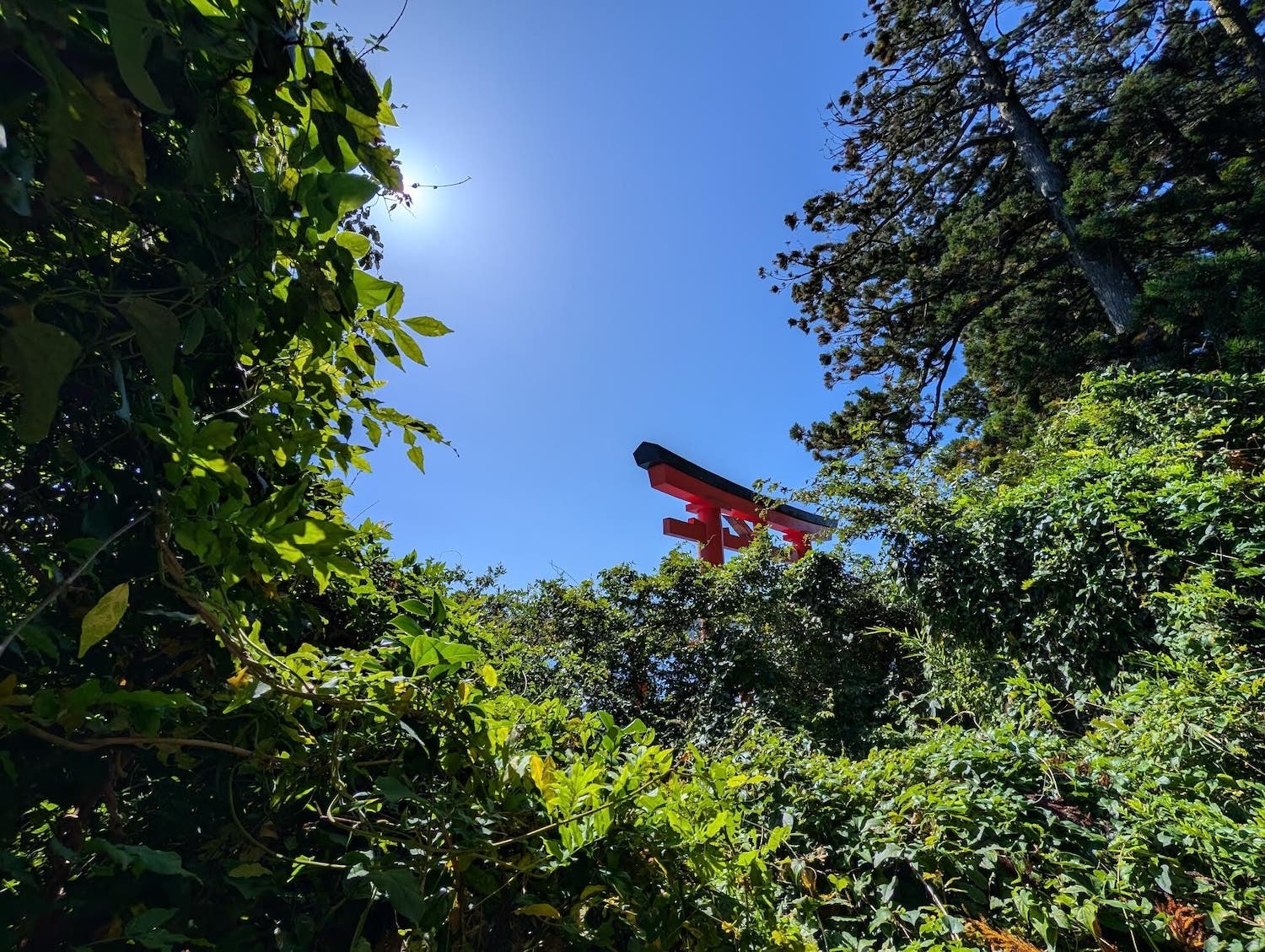
A red torii, the statuesque gate emblematic of a trip to Japan, seen from the trail on the author’s trip. (Photo: Ryleigh Norgrove)
Lake Ashinoko Loop
For something quieter and closer to the water, the Lake Ashinoko Loop is your low-key, scenic option. Link shoreline paths, forest singletrack, and quiet roads into a roughly 12-mile circuit around Lake Ashinoko. The north shore is the most scenic stretch, with forest paths and consistent lake views. It’s the kind of half-day wander that pairs well with shrine visits, a boat ride, or a lakeside lunch.
To get there: Most people start in either Moto-Hakone or Hakone-en and follow the wayfinding signs along the shoreline. Buses circle the lake, so you can always cut the loop short if you’re looking to explore other areas.
AloJapan.com