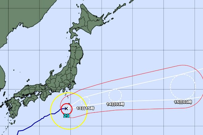
Typhoon No. 23 south of Japan is expected to maintain its intensity and put areas of the Izu islands at danger of strong winds and landslides, the Japan Meteorological Agency said Oct. 13.
Some parts of the island chain remain at heightened risk of disaster due to the lingering effects of Typhoon No. 22, which struck on Oct. 9.
The JMA is urging residents to be on high alert because the violent winds could be strong enough to topple utility poles and damage buildings.
According to the agency, as of 6 a.m. on Oct. 13, Typhoon No. 23 was estimated to be moving east-northeast at 30 kph near Aogashima island.
The typhoon’s central pressure is estimated at 970 hectopascals with maximum sustained winds of 126 kph and maximum gusts reaching 180 kph.
Heavy rain has already begun in some areas. The 24-hour rainfall expected by the morning of Oct. 14 could reach 200 millimeters in some parts of the Izu islands.


AloJapan.com