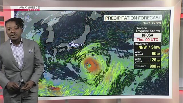
Weather officials in Japan say severe tropical storm Krosa may approach the Izu island chain from Friday and the Kanto region, including Tokyo, on Saturday.
The officials are calling for vigilance over gusty winds, high waves, rain-triggered landslides, flooding in low-lying areas and swollen rivers.
The Japan Meteorological Agency says Krosa was 320 kilometers north-northeast of Chichijima island in the Ogasawara island chain at 6 a.m. on Thursday. It says the storm is slowly traveling north.
Krosa has a central atmospheric pressure of 980 hectopascals. It is packing winds of up to 90 kilometers per hour near its center, with peak gusts of 126 kilometers per hour.
The agency says winds of more than 54 kilometers per hour are raging within 280 kilometers from the center to the southeast and 220 kilometers to the northwest.
Weather officials say Krosa may come very close to the Izu island chain south of central Tokyo on Friday while gathering strength, and approach the Kanto region around Saturday.
They say developed rainclouds from the storm may blanket the island chain and the region, bringing heavy rainfall from Friday to Saturday.
In the 24-hour period through Saturday morning, up to 200 millimeters of rainfall is expected in the Izu Islands and up to 120 millimeters in the Kanto region.
Very strong winds are expected for the islands and the region, with the stormy weather causing rough seas from Friday to Saturday.


AloJapan.com